Wired for Wildlife, Watched by Default
By Zig Mackintosh
Today’s anti-poaching strategies have changed from those of 10 or even 5 years ago.
While rangers, trackers, and patrols are still front and center, security systems have evolved over the last decade as technology has become a crucial component.
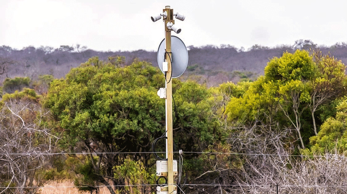
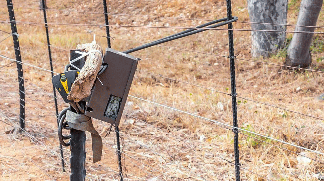
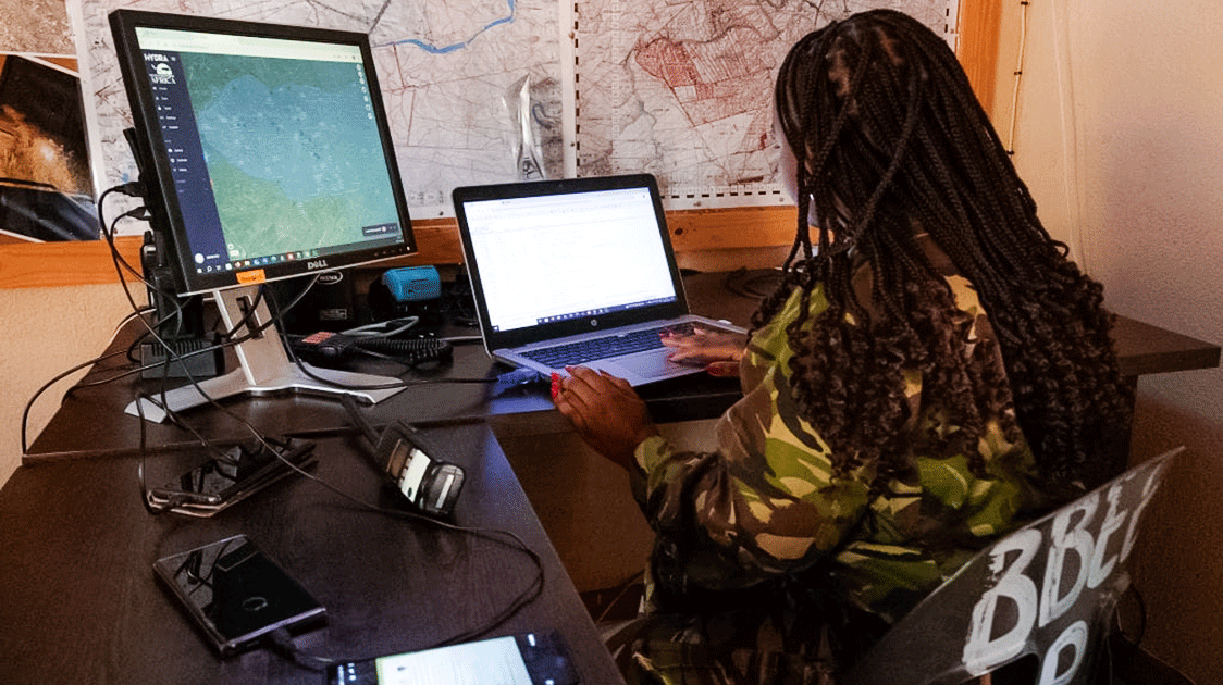
Now, command centers pull live feeds from thermal cameras on fence lines and pick up license plate numbers on approach roads while drones fly grids across the bushveld.
Progression was inevitable as the criminals are no longer simply poachers. They have evolved into highly organized syndicates overseeing training, logistics, and communications in cross-border operations.
Tulani Ngwenya at Oxpeckers Investigative Environmental Journalism has compiled an in-depth report on these developments and the potential consequences in the Kruger National Park and surrounds.
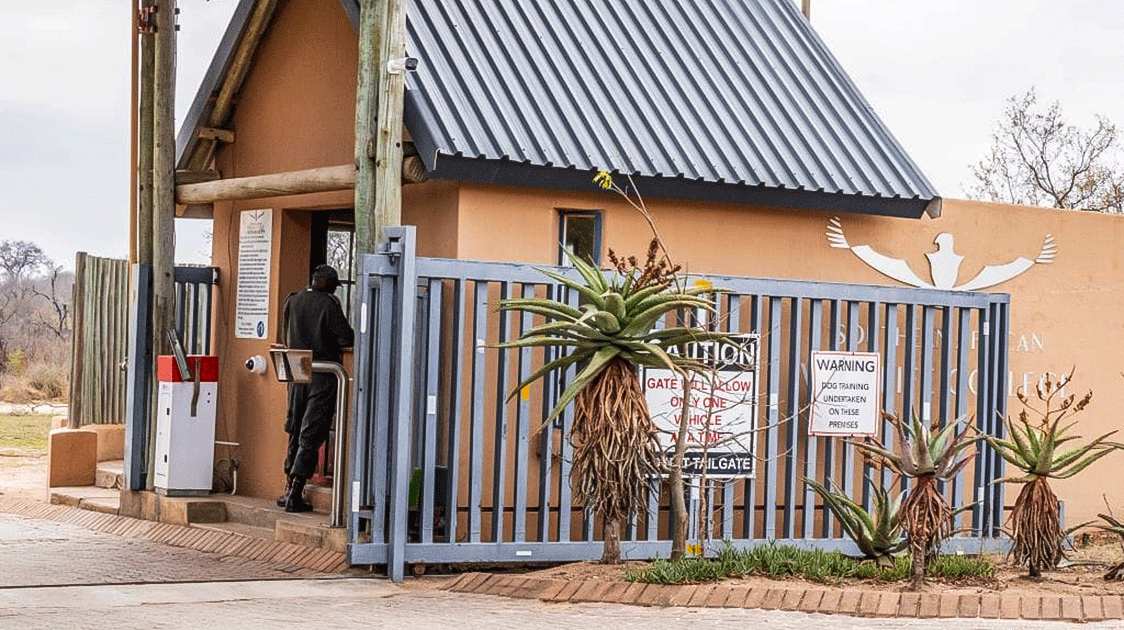
What the Network Looks Like
Ngwenya found that Kruger’s security network’s reach is greater than expected and doesn't stop at the boundary fence.
He coined the phrase "green panopticon" to describe what has emerged: a system where, in these landscapes, almost nothing goes unobserved.
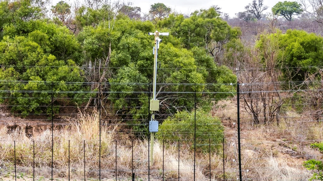
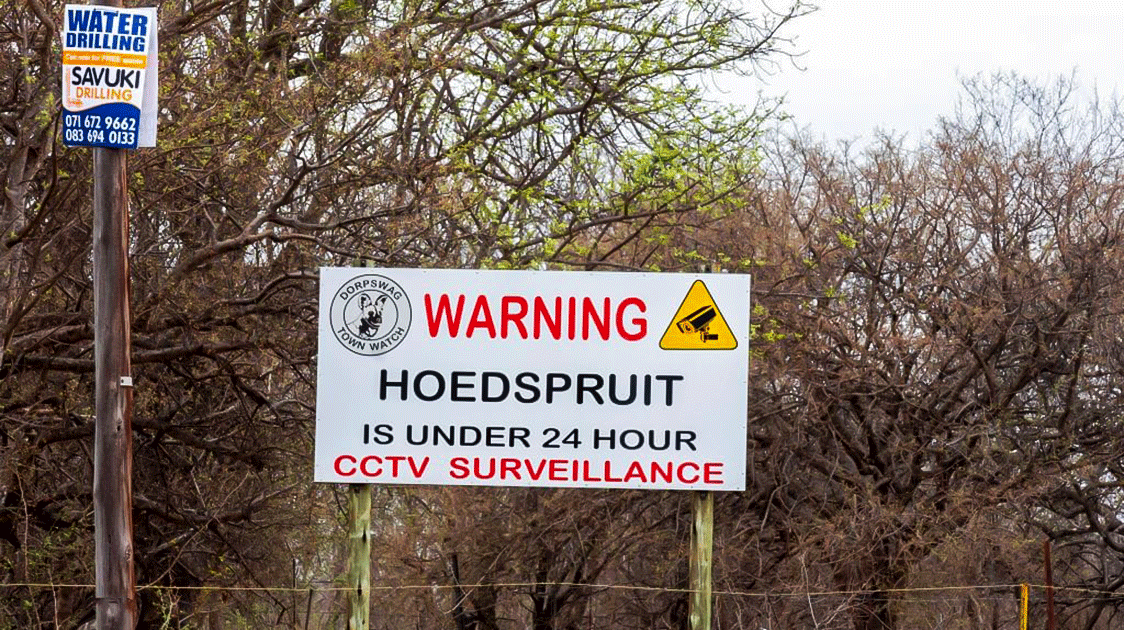
All movement along roads leading into the park, in nearby towns, and in transit corridors is monitored for suspicious behavior. Potential suspects are identified well before they reach the boundary.
Throughout the night, thermal imaging is employed while drones cover distances that would take hours in a vehicle. At key access points, license plate recognition logs every vehicle while the operators in the command centers pull all the data together in real time.
The mission is to intercept rather than respond.
If a vehicle is flagged moving suspiciously along a section of road, rangers can be deployed to investigate. It's too late if the fence has already been cut.
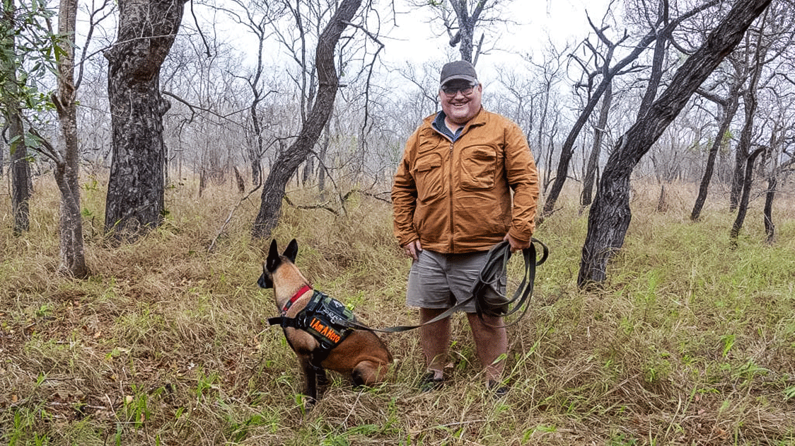
Fieldcraft is still essential; an experienced tracker is more useful in chasing a poacher than a computer mouse, but the reach has been expanded, and limited resources can be deployed more effectively.
Response times drop with accurate intel, and the rangers stop chasing ghosts.
Conservation Meets National Security
The conservation landscape has changed, and wildlife crime is increasingly being treated as a national security issue.
Field operations around Kruger have at times drawn in support from the South African National Defense Force under initiatives such as Operation Corona.
Language used in these operations, such as "incursions", "threat actors", "neutralization", is not typically used in conservation-speak.
This is counterinsurgency doctrine; a reflection of how seriously the threat is being treated as the syndicates become more sophisticated.
But this all comes with risks as conservation policies drift from a community-based approach towards enforcement and control. It normalizes constant surveillance across rural landscapes where privacy may not have been formally guaranteed, but at least existed in practice.
Whether those trade-offs are acceptable depends on who you ask. Communities living alongside parks view the situation differently from the operators watching the screens.
Who Oxpeckers Is and Why It Matters
Oxpeckers is not a typical conservation media operation. Most of that space is filled with sensational press releases, biased opinions, and donation appeals.
Founded by veteran environmental journalist Fiona Macleod, it has developed a methodology that other conservation media outlets do not use.
Oxpeckers works from data, court records, procurement documents, and sources that take years to nurture.
The organization combines traditional investigative reporting with data analysis and geo-mapping tools to expose eco-offences across southern Africa.
It trains journalists through its WildEye Academy and uses mapping and forensic data tools to track criminal syndicates across borders.
Tulani Ngwenya came up through that system.
He trained at the WildEye Academy in 2021, is a former trainee of WWF's Khetha Programme, and holds a Master's in cultural and media studies from the University of KwaZulu-Natal, where he is currently pursuing his PhD.
His previous investigations include work on ranger collusion with poaching syndicates, a kind of story that requires years of access and source trust to report properly.
The green panopticon investigation, using the Promotion of Access to Information Act (PAIA), sent information requests to SANParks, the North West Parks Board, and the South African Police Service (SAPS).
There was one simple question: who controls the surveillance data, and who has access to it?
The responses were either vague or not forthcoming.
What Needs to be Resolved
The high-tech, militarized approach is producing results with more precision operations, faster response times, and declining poaching numbers. For wildlife rangers who have spent years on the back foot, the gains are real.
The unresolved part is governance.
Data is being collected at scale, but the systems for storing, sharing, and overseeing it have not kept pace. South Africa's Protection of Personal Information Act (POPIA) has security exemptions broad enough to give these systems room to grow with limited scrutiny.
Communities bordering protected areas are an integral part of them, for better or for worse. If that reality is not appreciated, cooperation and coexistence cannot be achieved.
Licence plate recognition does not distinguish between a poacher, a tourist, and a local commuter. Data is collected continuously, often without the knowledge of those being recorded.
The aim is to target criminal behavior, but the net is all-encompassing. Surveillance infrastructure without clear accountability is legally and politically exposed in ways that jeopardize the whole process.
Misidentification, data errors, and algorithmic bias can flag innocent people, particularly in areas where trust between communities and authorities is already fragile.
A wrongly flagged vehicle or a misread movement pattern can escalate quickly, with little transparency into how decisions are made or reviewed.
Getting the framework right is in everyone's interest.
Ngwenya's reporting makes that point without becoming alarmist. And that’s not easy.
Read the full investigation at https://oxpeckers.org/2026/02/the-green-panopticon/
Zimbabwean native Zig Mackintosh has been involved in wildlife conservation and filmmaking for 40 years. Over the years, he has traveled to more than 30 countries, documenting various aspects of wildlife conservation. The sustainable use of natural resources as an essential conservation tool is a fundamental theme in the film productions with which he is associated.