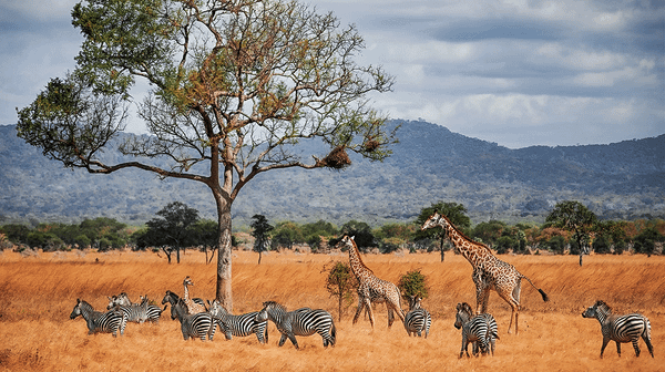
Zambia
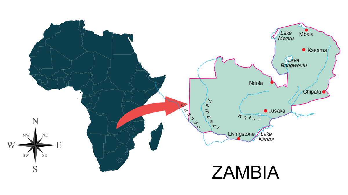
Zambia is a landlocked country the size of Texas and Oklahoma combined, with around 30 percent of its territory under some form of wildlife protection.
The conservation landscape is shaped by four major river systems (the Zambezi, Kafue, Luangwa and Chambeshi), a network of national parks that ranks among Africa’s largest by total area, and a buffer-zone model built on Game Management Areas.
The country also sits at the centre of the African rosewood crisis. Mukula trafficking from Zambia to China has driven a decade of regulatory churn and is the most consequential timber-crime story on the continent.
Bushmeat poaching, mostly with wire snares and rifles in Game Management Areas, is the larger problem in terms of volume.
How conservation is organised
There are four categories of conservation organizations in Zambia.
Department of National Parks and Wildlife (DNPW). The government wildlife authority, sitting under the Ministry of Tourism. DNPW employs the rangers responsible for protected areas and for licensing in Game Management Areas.
It is chronically underfunded.
NGO management partnerships. Several of Zambia’s most important parks are managed under co-management agreements between DNPW and conservation NGOs.
African Parks runs Liuwa Plain (since 2003), Bangweulu Wetlands (since 2008), and took on Kafue National Park, Africa’s third-largest park at 22,400 km², in 2022.
Frankfurt Zoological Society has worked in North Luangwa for over 40 years.
Conservation South Luangwa and Conservation Lower Zambezi operate alongside DNPW in their respective parks.
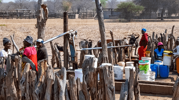
Community scouts in Game Management Areas (GMAs)
GMAs surround most major parks and are jointly managed by DNPW and local communities.
Scouts are recruited from the resident chiefdoms. Zambia’s revenue-sharing model returns 50 percent of trophy fees from regulated hunting to GMA communities, plus an annual game meat distribution that runs to thousands of kilograms per community.
Patrol covered the broader framework in Payments for Ecosystem Services in African Conservation.
Safari hunting concession operators
Hunting concessions in GMAs are leased to professional hunting operators by the government. In practice, the operator often funds the bulk of the anti-poaching work in the concession, including ranger salaries, vehicles, and fuel.
Fico Vidale’s 1,800 km² Lunga-Busanga concession on the western boundary of Kafue is one of the better-documented cases, covered in A Wilderness on the Edge (full 26-minute documentary) and the field-tactics piece To Catch a Poacher.
The major landscapes
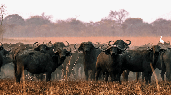
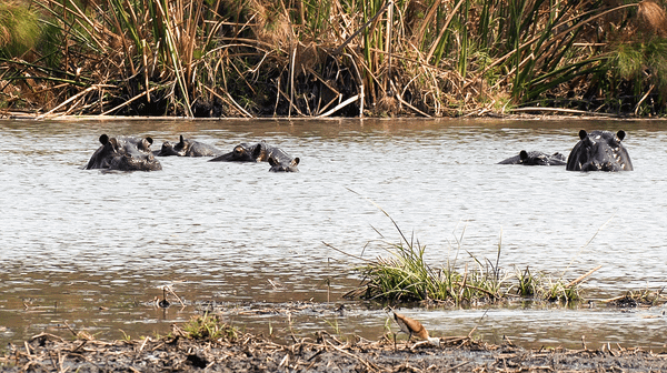
Kafue and the Busanga Plains
Kafue National Park covers 22,400 km² in central-western Zambia, flanked by a ring of GMAs including Lunga-Busanga, Mumbwa, Namwala, and Mulobezi.
The Busanga Plains in the northern park are 720 km² of seasonal floodplain fed by the Lufupa River, one of the most productive wildlife systems in southern Africa. Patrol covered the area in The Busanga Plains: A Wetland Paradise Under Pressure.
The pressure comes from fish poaching (the floods are a breeding ground, and the dry-season fish concentrations are easy to net), snaring along the floodplain edges, and elephant poaching in the dry season.
South and North Luangwa
The Luangwa Valley runs north-south along Zambia’s eastern border, between the Muchinga escarpment and the Luangwa River. South Luangwa National Park (9,050 km²) is the better-known of the two and has had a long-running co-management arrangement with Conservation South Luangwa.
North Luangwa, where Frankfurt Zoological Society has worked for four decades, holds Zambia’s only reintroduced black rhino population.
Lower Zambezi
Lower Zambezi National Park (4,092 km²) sits on the Zambezi River across from Mana Pools in Zimbabwe.
The park is roadless in much of its interior, and the river is the main movement corridor for both wildlife and poacher activity.
Conservation Lower Zambezi runs the main anti-poaching support operation. Cross-border coordination with Zimbabwean rangers matters here as much as anything that happens on the Zambian side.
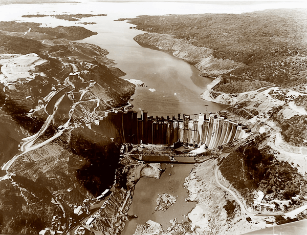
The history of the river system itself is covered in People Versus Wildlife: The Kariba Dam Saga.
Bangweulu Wetlands
A 6,000 km² floodplain in the north, managed under an African Parks partnership.
Bangweulu is the principal stronghold for the shoebill stork and the swamp-adapted black lechwe. Fish, lechwe, and shoebill chicks are the main poaching targets.
The main threats
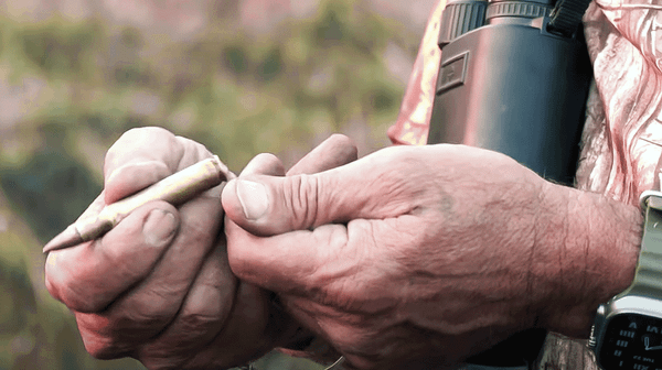
Bushmeat
Snaring is the dominant method. Wire is sourced from fences, telephone cable, and motorbike clutch and brake cables.
The boda-boda supply chain applies across Zambia as it does in East Africa.
A 2010s study showed that Zambian poachers participating in the bushmeat trade earned a median income of US$48 per month, compared with US$15 for non-participants, providing a useful indication of the rural economic pull of the activity.
Mukula rosewood
Pterocarpus tinctorius, sold internationally as rosewood and known locally as mukula, has been the central African timber-crime story since around 2010. Zambia is the source country.
The Zambian government has cycled through export bans, production bans, and transportation bans for over a decade, each round short-lived.
Trafficking moves through DRC, Malawi, Mozambique, Tanzania, Namibia, and South Africa to Chinese ports.
Elephant poaching
Zambia’s elephant numbers fell sharply during the 1970s and 1980s commercial ivory era. The current picture is mixed. Lower Zambezi and Kafue still see ivory poaching, often by groups crossing from neighbouring countries. North Luangwa’s black rhino population is the more sensitive headline target.
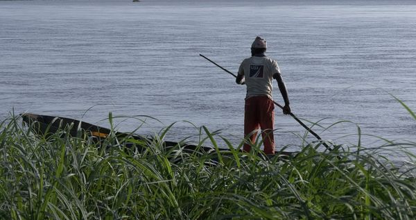
Fish poaching
Fishing using illegal gear and methods within protected areas is a persistent problem in the Kafue floodplain, the Bangweulu wetlands, and the Zambezi.
African Parks in Kafue registers individual fishermen with numbered shirts at licensed fish weirs to try to separate legal from illegal effort.
Some still use fishing as cover for poaching, as To Catch a Poacher documents.
Charcoal production
Miombo woodland is the dominant vegetation across most of Zambia, and miombo is a good charcoal wood. Charcoal production for the urban markets of Lusaka and the Copperbelt is the largest single driver of deforestation outside the rosewood trade, and charcoal camps in or near protected areas are a regular find on anti-poaching patrols.
What works
Three structural elements explain why Zambian conservation has held its ground in some places and lost it in others. Property Rights and Economic Efficiency and The Right to Decide? Both set out the underlying argument.
Where rural communities derive meaningful, regular income from wildlife (the 50 percent trophy-fee share, the annual game meat distribution, employment as scouts and camp staff, and photographic tourism revenue), illegal offtake by community members tends to fall, and informant flow tends to rise.
Where they don’t, the calculus reverses.
Where a competent partner is funding the operation (African Parks in Kafue, Bangweulu, and Liuwa; FZS in North Luangwa; private hunting operators in their concessions), the anti-poaching work has continuity.
Where DNPW is on its own, continuity is the first thing that goes when budgets tighten.
Cross-border coordination matters disproportionately. Mukula moves through eight countries. Ivory and bushmeat move through three or four. Zambia’s borders with the DRC, Tanzania, Malawi, Mozambique, Zimbabwe, Botswana, Namibia, and Angola are mostly porous.
Single-country enforcement does not catch this trade.