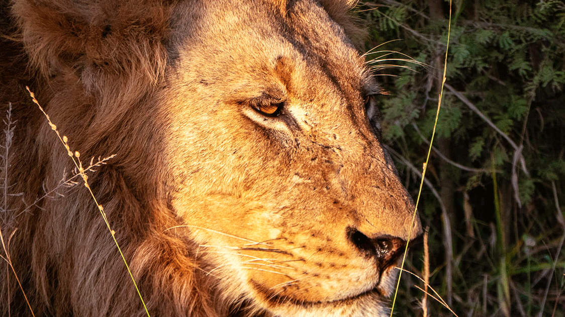
A Ticking Time-bomb: Beyond Kruger’s Fences
Key Takeaways
- 750,000 people live on Kruger's western boundary, a fast-growing population shaped by apartheid-era forced removals.
- Settlement-driven habitat loss is the central, irreversible pressure. Between 1993 and 2006, settlement area grew by almost 40 percent, woodland fell by about 27 percent, and roadside growth is severing the corridors to the western escarpment.
- Households still draw on a shrinking resource base. In some places, more than 90 percent of households burn wood despite electrification.
- Kruger's water security begins outside the fence. The park's southern rivers rise in the communal lands to the west, where abstraction, losses, and sand mining feed the Sabie-Sand system that is already ecologically stressed.
- Wildlife crime tracks the local economy. Affordable power and a benefit-sharing scheme that pays out would do more for security than more patrols.
The western fence of the Kruger National Park runs for hundreds of kilometers along one of the most densely settled rural landscapes in South Africa.
This is Bushbuckridge, where a very large, very poor, and fast-growing population of more than 750,000 people live on the edge of a national treasure.
The pressures on Kruger's natural resources are most apparent here, and the limits of conventional conservation practices are clearly visible.
Bushbuckridge was shaped by apartheid and comprises two former homelands: the Mhala district of Gazankulu, set aside for the Tsonga and Shangaan peoples, and the Mapulaneng district of Lebowa, set aside for the Northern Sotho and Pedi peoples.
Through the 1960s and 1970s, tens of thousands of people were forcibly relocated here, many onto former white-owned farms that grew into dense settlements such as Acornhoek, Cottondale, Dwarsloop and Green Valley.
The policy of betterment planning concentrated scattered homesteads into villages and cut access to land, which pushed men into migrant labor and left households dependent on the surrounding bush and, later, on state grants.
Vestiges of the policy remain: the land is state-owned but held under customary tenure, with the traditional authorities regulating residential, grazing, and arable zones. This makes settlement and land-use difficult to plan and control, especially with an ever-growing population.
In the 2001 census, the population was pegged at 500,000; by 2022, it exceeded 750,000, with an estimated undercount of close to a third.
Bushbuckridge lies within the Kruger to Canyons Biosphere Reserve, one of the largest in the country, declared by UNESCO in 2001. Its primary objective is to balance human livelihoods with ecological function across a reserve of about 2.5 million hectares, where, in places, there are 150 to 350 people per square kilometer.
The spread of settlement is the clearest fundamental pressure. Satellite analysis of the biosphere found that more than a third of it changed land-cover class between 1993 and 2006.
The settlement area increased by almost 40%, while intact vegetation declined around it.
Within the remaining intact vegetation, woodland fell by about 27 percent while thicket and bushland rose, a signature of bush encroachment.
But there’s more to the story.
Villages are not just spreading; they are densifying and merging, so blocks of habitat are lost outright rather than just thinned. In places such as the Numbi gate, informal settlement now reaches the fence itself.
Growth follows the roads, which severs the wildlife corridors that link Kruger to the western escarpment.
Settlement has outpaced the growth of usable communal land, meaning more is being drawn from a dwindling resource base, raising the obvious question of whether this is sustainable.
This shrinking resource base remains an active part of the household economy, and fuelwood is central.
Almost no households had electricity in 1991, yet nearly all were connected to the grid by 2002; however, wood collection did not fall with it, even under a policy of 50 kWh of free electricity per household per month.
In some areas, more than 90% of households still burn wood for cooking and heating because it’s cheaper than the fickle electricity supply.
One model forecast that local woody biomass could be exhausted within about thirteen years at the extraction rates of the day.
But careful LiDAR measurements found that woody biomass in three communal rangelands actually rose between 2008 and 2012 because heavily cut species coppice and resprout quickly.
Extraction is changing the structure of the woodland, with mature trees giving way to multi-stemmed regrowth, while fuelwood is sourced from further afield, masking the scarcity.
The land around the villages is used for crops and livestock grazing, which is continuous rather than rotational.
Cattle tracked in the Bushbuckridge communal lands ranged across seasonal home ranges of roughly 3 to 15 square kilometers, moving farther in the wet season and concentrating near water and villages in the dry season.
The conservation significance of grazing is subtler than that of fuelwood or settlement.
Heavy, continuous stocking pressure thins palatable grass, promotes woody encroachment, and competes with wild herbivores for forage along the boundary.
Cattle that stray through broken fencing into the park raise disease-control and predation problems.
The river systems
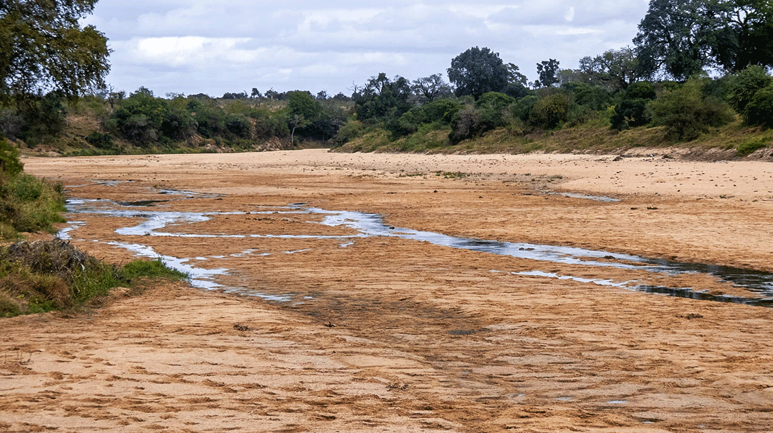
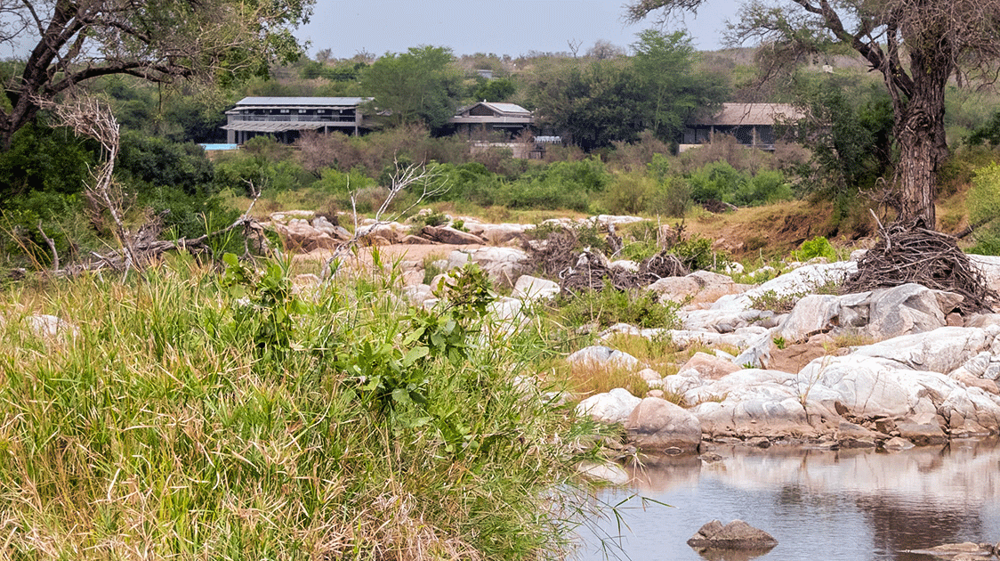
Kruger's southern rivers rise west of the park, so water management in Bushbuckridge is a conservation issue for the park itself. The Sand River flows through the communal lands and the Sabi Sand reserves before joining the Sabie River near Skukuza inside Kruger.
The Sabie-Sand catchment supplies both the growing population and the park's ecological flow requirements. Inyaka Dam on the Marite River was completed in 2001.
It anchors the regional supply scheme and serves around half a million people in the Bushbuckridge area. It also helps secure downstream flow into Kruger and on to Mozambique.
The pressure is one of rising demand against a fixed and variable supply. Population growth, in-migration and service delivery all increase abstraction, while distribution losses are high.
The park's high ecological flow requirements sit alongside rural water needs within the same system, and analysts have warned that the catchment could become water-stressed as demand rises.
The Sand, Sabie, and Olifants rivers within Kruger are already classified as ecologically stressed to varying degrees. The 1992 drought, which dried the rivers and triggered the dam's construction, is a reminder of how quickly the system can fail under climatic stress.
Sand mining in rivers for construction is another concern, as it degrades the riverbanks within the catchment that Kruger depends on downstream.
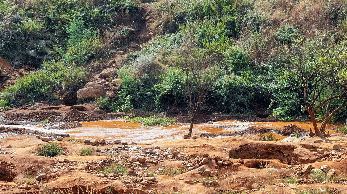
The illegal gold mining along the river banks and gold panning within the rivers is causing serious environmental damage by the "Zama zamas".
The fence
The western boundary fence is the front line of human-wildlife conflict.
The fence was erected in part to block elephant movement and contain foot-and-mouth disease, and it remains the main barrier between the park's wildlife and the dense human settlement.
It is also extremely porous.
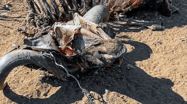
It is breached by elephants, floods and people, and each breach opens the way to crop raiding, livestock predation, property damage and risk to human life.
Conflict has intensified where fencing has vanished.
Predators leaving the park have killed cattle, prompting community calls for the fence to be rebuilt, while elephants have repeatedly destroyed fence sections at points such as Letaba Ranch.
Recovery of livestock that strays into the park is restricted by protected-area and disease-control law, which leaves owners carrying the loss and deepens resentment.
These incidents feed directly into community attitudes.
A service-delivery monitor recorded 25 major protests in the Bushbuckridge area since 2011, often involving the closure of park access roads.
Compensation, rapid-response teams, fencing upgrades and outreach are essential, but each has limits:
- Compensation schemes are slow and contested
- Fencing is expensive to maintain against elephants and floods
- Outreach struggles where the park is seen as land taken from the community's forebears
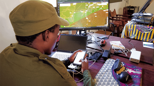
A fence stewardship program now deploys dozens of community-drawn environmental monitors along roughly 400 kilometers of the western boundary to manage fence integrity.
This is a promising development because it places boundary residents in paid conservation roles, which addresses both fence integrity and the legitimacy problem at once.
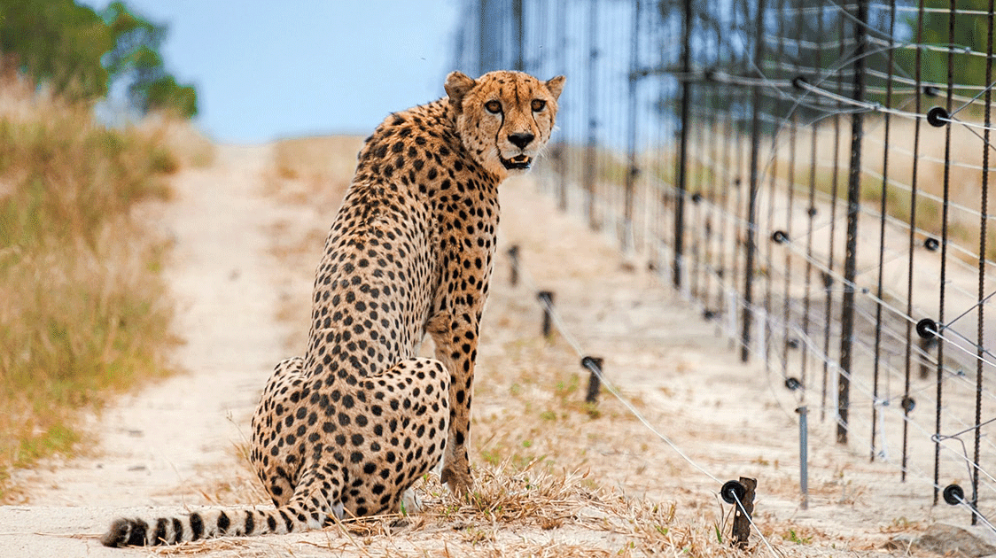
Wildlife crime
Wildlife crime is the most visible conservation pressure with two distinct components.
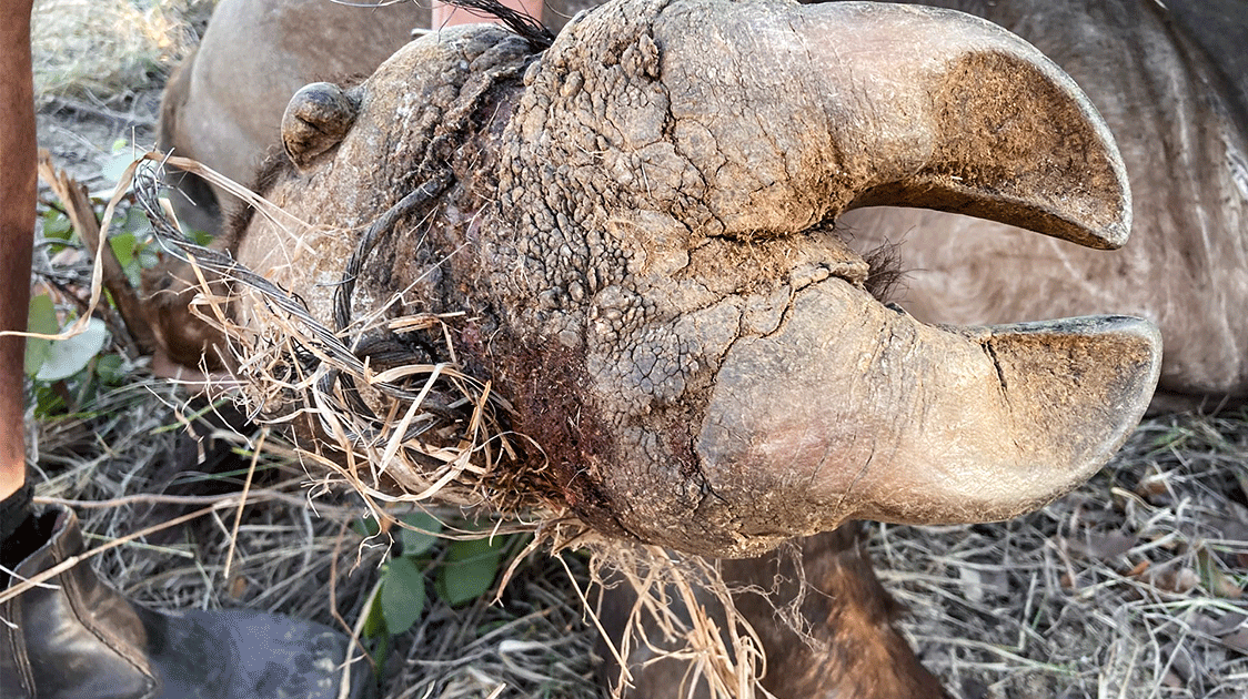
The first is rhino poaching driven by transnational organized crime and Asian horn demand.
Kruger lost 78 rhinos in 2023, 88 in 2024 and 175 in 2025, nearly doubling in a single year, even as the national total fell from 420 to 352. Mpumalanga was the hardest-hit province in 2025.
The second threat is the surging bushmeat poaching through snaring and shooting and the traditional-medicine trade.
Snaring is indiscriminate, affects both target and non-target species, and is difficult to police because the financial barriers to entry are low and the potential returns are high.
Both components rest on the same socio-economic base. Youth unemployment in Bushbuckridge is around 60 percent, and the gap between desperate poverty and the value of wildlife inside the fence is overwhelming.
And then there is the internal corruption within the Kruger Park management.
Independent reporting has documented Kruger rangers being drawn into syndicate networks by low pay, debt, and family ties, undermining every other anti-poaching investment.
With all these issues, the question is how to provide tangible benefits.
In 2016, six communities settled claims over roughly 318,000 hectares of Kruger, through equitable redress amounting to about 84 million rand and a promise of access to the park economy.
The benefit-sharing half of that deal then stalled for most of a decade.
A beneficiation agreement was signed only at the park's centenary, granting claimant communities structured access to tourism, enterprise and employment without transferring ownership.
This delay was a serious issue because trust is lost when people see neither land nor a timely share of the park's income; the park reads as an extension of the dispossession that created Bushbuckridge in the first place.
That perception weakens outreach and deepens the pool from which wildlife-crime recruits are drawn.
The Makuleke contractual park in the north of Kruger shows how restored rights can sit alongside continued conservation-through-community tourism.
Benefit-sharing must not be considered as charity bolted onto conservation; it is an integral part of the overall strategy.
The next 25 years
Bushbuckridge will continue to grow and densify, and settlement will fill the gaps between villages and corridors.
Pressure to expand and intensify cropping and livestock will grow with the population, especially where water transfers from Inyaka make it possible, raising abstraction and converting what rangeland remains.
Tourism, the main legitimate source of local income, will grow too, bringing its own roads, lodges and traffic.
The Lowveld is already drought-prone, and climate projections for Mpumalanga indicate higher temperatures, increased evaporation, and more frequent severe droughts.
The 2015 and 2016 El Niño droughts ranked among the most extreme in Kruger's climate record, and the looming El Niño for 2026/27 will test the resilience of both the park and its surrounding human populations.
Drought is the multiplier. When the rivers drop and the rangeland fails, more households turn to the bush for survival.
Of the pressures described here, the most certain over the long run is settlement-driven habitat loss, because it is already underway and cannot be reversed at scale.
The weakest link
Fences and law enforcement are essential, and the work of securing the western edge of Kruger is dangerous. The fence is not failing due to lack of dedication.
It is under strain because the economic realities facing a household at the fence have not changed.
Affordable, reliable power would do more to ease fuelwood pressure than any patrol.
A benefit-sharing scheme that actually pays out would do more for rhino security than another integrity test.
Catchment management that keeps the rivers flowing protects both the people and the park.
The fence will hold only as well as the relationship across it.
For now, that relationship is the weakest link.